
The Mayas inhabited a huge swath of land encompassing Mexico’s Yucatan peninsula, Belize, Guatemala, Honduras and El Salvador. Evidence of their complex civilization dates back more than 3,000 years and interpretations develop with each new discovery and scientific breakthrough.
The Mayan people had sophisticated societies with common belief systems administered by hierarchy whose rulings radiated to other cities connected by trade routes. They were intellectually astute and are credited with creating mathematical theories and mapping the course of planets and stars. They developed an accurate calendar as well as medical and spiritual healing systems utilizing plants from the rainforest. Their cultural achievements are astounding, especially so, without the aid of metals, horses or the wheel.
Some estimates suggest upwards of two million Maya’s may have inhabited Belize (current population is 300,000). Their descendants in Belize are the Yucateca, Mopan and Ketchis. These people are primarily agrarian, with some still practicing forest gardening techniques handed down from before the Spanish conquest and have retained their language and culture.
Caracol (Snail) appears to have been a well to do city, thriving during the Classic period (250AD-850AD). One of the largest sites constructed in Belize, Caracol once held sway over the region and influenced and interacted with other important centers. This impressive site is composed of about 20 major plazas, each surrounded by temples, many with commemorative stone stelae. The main temple is Ca’ana and is 145 feet high. The view of the jungle from atop the pyramid is breathtaking.
Excavations at Caracol have yielded many facts about the Maya, but have exposed more mysteries left yet to unravel. There are numerous causeways emanating from the center of Caracol to outside settlements and farming zones. These causeways traverse an area populated with elaborate structures covered by thick jungle foliage. Caracol is situated deep within the Chiquibul Forest in the Cayo district. It is accessed from the Mountain Pine Ridge and is a wonderful full day trip.
www.caracol.org.
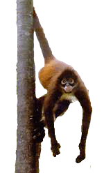
Xunantunich (Stone Woman), was a Classic period Maya ceremonial center, perched high on a hilltop overlooking the Mopan River in the Cayo district. This site reached its peak at the close of the Late Classic Period (850AD), when Tikal had already begun to be abandoned and the Maya were ceding their organized reign of the region. The highest pyramid is El Castillo, which at 130 feet, offers a beautiful view of the villages below and into neighboring Guatemala.
The most remarkable features at Xunantunich are the stucco friezes that band two sides of El Castillo, representing the moon and sun gods, Venus, a jaguar, a headless person and the days of the Maya week.
El Pilar, (Watering Basin) is the largest center in the Mopan River area with its temples, palaces and plazas covering more than 120 acres. Some buildings reached 65 feet in height and the once paved public plaza was larger than a soccer field. Occupation and construction began in the Pre-Classic period before 700 BC when Rome was founded and continued in the Terminal Classic period near AD 1000, after major local centers like Tikal had already been abandoned. Many of the largest structures reached their massive extent in the Late Classic period, when the rest of the Maya civilization was also at its height. Interestingly, both El Pilar and Xunantunich were still vital centers in the Terminal era.
El Pilar’s monuments straddle the Belize-Guatemala border and were unified in antiquity by an ancient Maya causeway. In collaboration with the governments of Belize and Guatemala, Archeologist Dr Anabel Ford has helped create a cooperative reserve so that these ancient monuments can be re-united under the forest canopy with involvement from both countries and the communities that surround this protected area. www.marc.ucsb.edu
Cahal Pech (Place of Ticks) is a ceremonial center overlooking San Ignacio town in the Cayo district. It’s a small site, settled in 1000BC and abandoned by 800AD. It is in the same river valley as Xunantunich and not more than 12 miles from El Pilar. Dr Jaime Awe’s expert attention to the site revealed that Cahal Pech appears to have been important during the late Preclassic period between 300BC-AD250. A royal tomb from the center yielded many ornate jade objects, obsidian, shell and bone ornaments, as well as a shell and jade mosaic mask probably worn as a belt worn by the noble buried in the tomb. Cahal Pech is an easy and short visit from town. www.bvar.org/cahalpech.com
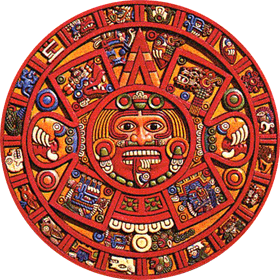
Lamanai (Submerged Crocodile) was an important ceremonial site with an occupation from the Preclassic through today, albeit in different forms. Earliest evidence dates to 1500BC and as the populations grew, so did the center, becoming one of the largest in Northern Belize. When Tikal was abandoned, so was much of the infrastructure at Lamanai, but that did not mean it was entirely abandoned. The surviving village was heavily engaged in trading, particularly of copper bells that were an important decorative item in the Post
Classic. People were living in the area in the 16th century, when the Spanish arrived and built a series of churches.
The site features monumental architecture of temples and palaces dating from Preclassic to Classic period. Lamanai was built along the banks of the New River Lagoon in the Orange Walk district and is a full day trip from Orange Walk, Belize City, San Pedro on Ambergris Caye or Caye Caulker. Current residents include troops of howler and spider monkeys. The river trip offers great birding and a chance to see morlets crocodiles, river otters, manatees and large assortment of water birds, including the jabiru stork. www.lamanai.org/Arch.htm.
Altun Ha’s (Stone Water) proximity to the sea would have made it an important site for trading and agricultural. Its small size can not diminish the fact that jade mined in Guatemala and extraordinary artifacts from as far away as Mexico City have been found at this site. The most remarkable artifact from Altun Ha is the carved jade head, which at 10 pounds, is also the largest ever excavated in the Maya empire.
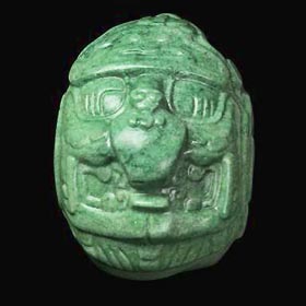
Altun Ha was among the first major archeological projects in Belize. The site was occupied from 350BC to about 950AD. Permanent structures were erected in the first century and centered on a reservoir, a natural depression in the ground with artificial clay lining and a dam. Building materials were dug from the ground creating more water quarries, allowing for more settlement. The population may have reached 10,000 at its peak. Activity continued until the 9th century, when some say the peasants revolted. Whatever the cause, the site was abandoned. There is evidence of Postclassic occupation continued at the site after the collapse around them. Altun Ha is a ½ day trip from Belize City and a full day trip from San Pedro on Ambergris or Caye Caulker.
Lubaantun (Place of Fallen Stones) and Nim Li Punit (Big Hat) are located in the Maya villages in the Toledo district. They are constructed of the dry masonry style of architecture conducive to the type of bedrock found in the south. These two representations of the Maya of southern Belize are very interesting and enchanting.
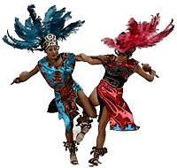
The pyramids at Lubaantun were assembled without mortar and like many Maya temples; most of the super structures built on top of the pyramids no longer exist. They were made from perishable materials, such as wood. Stelae are rare in this region and are not found here, which is in marked contrast to the many spectacular pieces at Nim Li Punit. Lubaantun was occupied from 730 AD to 890AD, a Late Classic site. It lies on the banks of the Rio Grande and was a major center for trade between the sea and mainland.
Nim Li Punit is not known for its structures, but is famed for its large and impressive collection of stelae, including one that exceeds 50 feet in length. Stelae were an important art form and chronicle of history. Nim Li Punit was occupied in the Late Classic period, much like nearby Lubaantun.
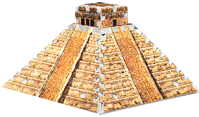
Tikal, perhaps the most magnificent site in the Maya empire, is just over the border in Guatemala. Tikal reigned over the region from 300BC to 900AD and is architecturally massive. You can easily see the highlights in a day or spend a night or two in the area to devote more time roaming through the park and this spectacular ancient city. There are accommodations in the park near the ruins that will appeal to people who are also interested in the resident wildlife. The nearby island village of Flores offers visitors a taste of Guatemala.
You can easily access a guided tour of Tikal from the Cayo district through the western border or from San Pedro on Ambergris Caye or Caye Caulker on one of two daily 50 minute flights between Belize International and Flores.
We can not fail to include the new Museum of Belize in Belize City. Its impressive collection of Maya artifacts is well worth the visit. You’ll see stunning antiquities artfully displayed.
This is a brief overview of the sites you will most likely be closest to and visit. It is by no means a complete list of all the ruins in Belize. Please feel free to email with any questions you may have.
Home |
About Belize |
Birding |
Caves |
Comments about Belize Trips |
Comment and contact form
Diving and snorkeling |
Fishing |
Getting to Belize |
Horses |
Maya sites |
Moving to Belize |
Payment and cancellation policy
Sailing, kayaking and canoeing |
Sample itineraries |
Spa |
Special travel |
Weddings
|